Fire Behavior Case Studies
Rough Draw Wildfire
Return to main page of print version
Introduction
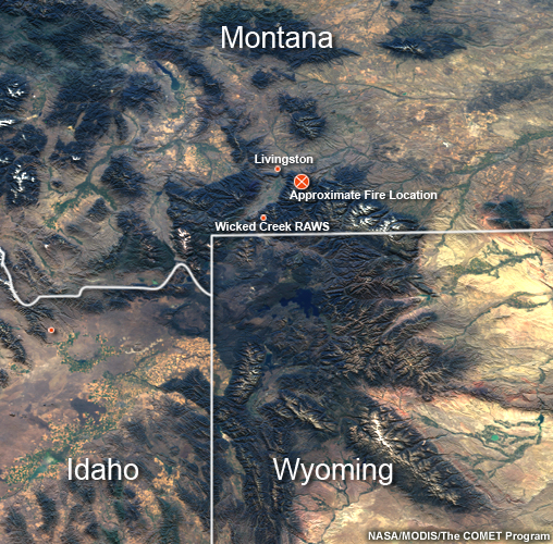
This case study examines a fire that occurred during mid-August, 2003 in the Absaroka Mountains southeast of Livingston, Montana.
Review the Fuels, Topography, and Weather sections (below) to learn about the environmental conditions for this fire.
Then, continue to the Fire Behavior section to make a prediction about the types of fire behavior you would expect for the given conditions. Once you have made this prediction, go to the Causal Factors section to answer a summary question about the causal factors for this fire.
Fuels
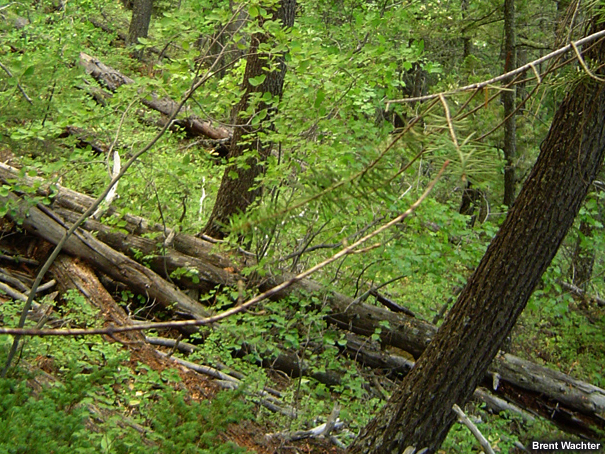
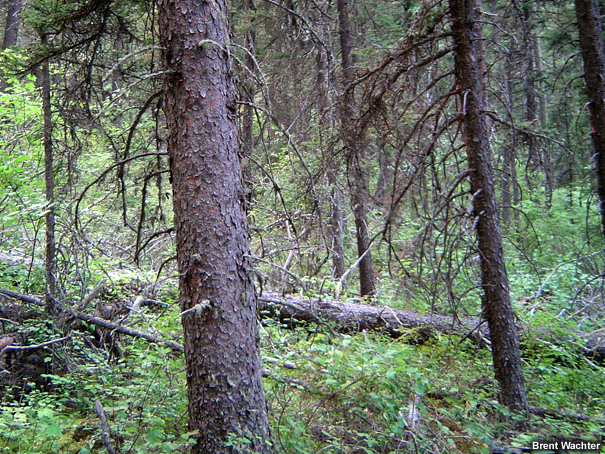
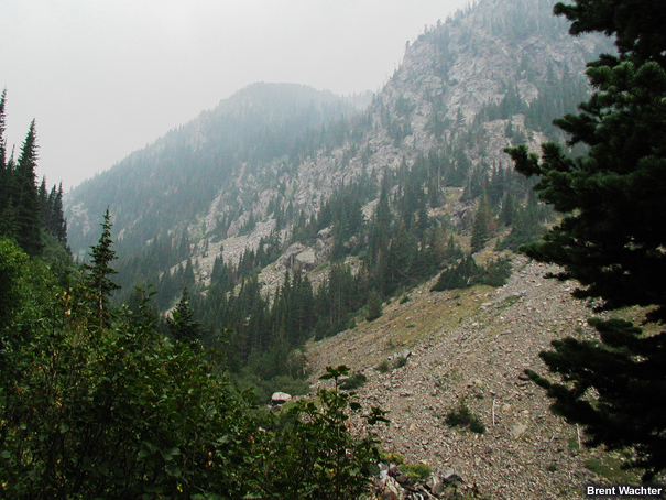
Fuels in the area of interest included lodgepole pine, sub-alpine fir, spruce fir mix, douglas fir, limber pine and white bark pine.
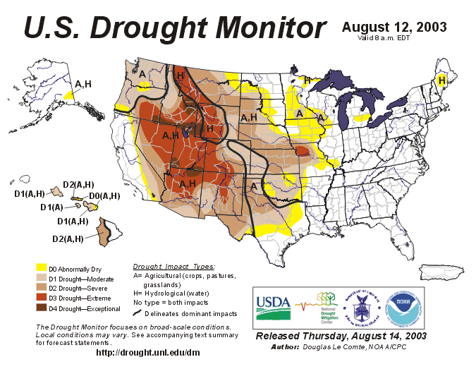
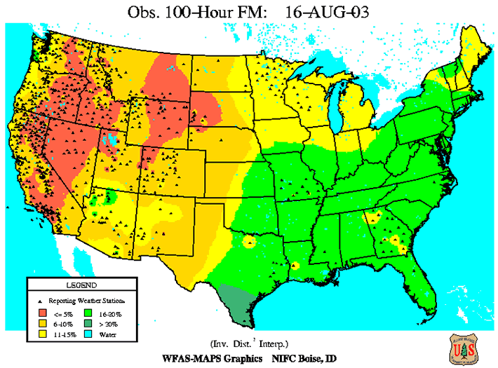
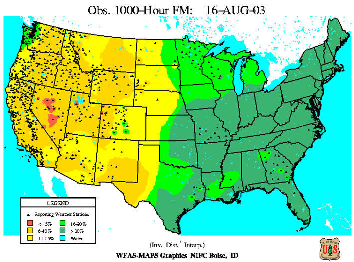
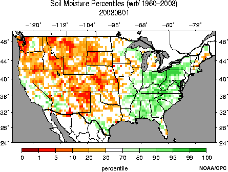
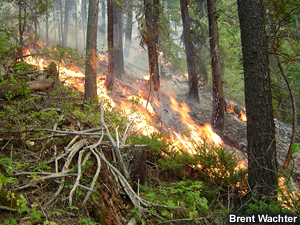
The canopies in this part of the forest were fairly continuous within a densly packed forest. At the surface, semi-cured herbaceous and woody fuels were intermixed with dead and down material such as jackpots containing heavier fuel. It is typical for dead fuel moistures to be low in August, but dryness was enhanced by pre-existing drought conditions. Live fuel moisture levels within the tree species were also below normal.
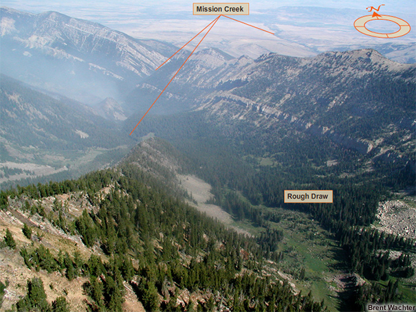
Examine the photos and data products below (you can click them to see enlarged versions) to form an understanding of the fuel situation for this fire. For more information about the data products presented, refer to the Assessing Fire Danger module in the Advanced Fire Weather Forecasters Course.
Topography
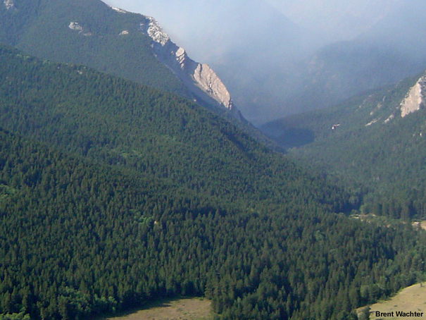
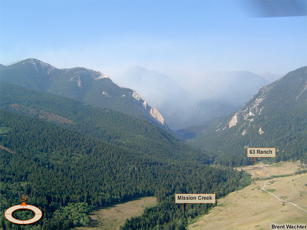
The Ojo Feliz fire occurred in a region situated to the lee of the north-south oriented Sangre de Cristo mountain range, with peaks over 13,000 ft tall. The fire area ranged in elevation between 7350-8300 ft.
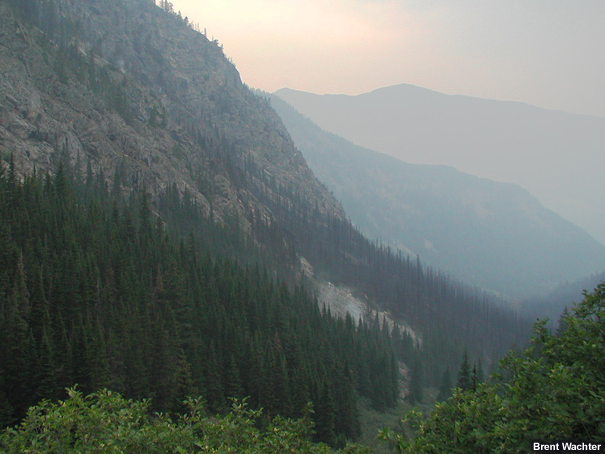
The terrain may be characterized as a gently sloped plateau with one embedded steep canyon. The general slope was calculated at 25-30% for this fire.
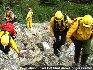
Examine the photos below (you can click them to see enlarged versions) to form an understanding of the terrain configuration for this fire.
Weather
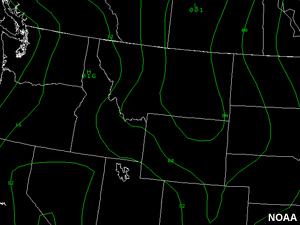
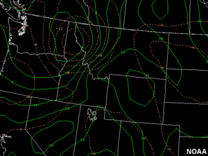
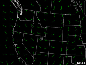
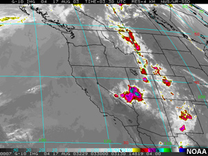
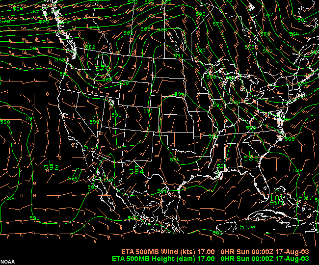
As this event unfolded, a large disturbance spread across the northern Rockies from the northwest. High-based thunderstorms were spawned ahead of the cold frontal boundary as it pushed eastward. Thunderstorm outflows generated strong gusts and shifting winds. With frontal passage thunderstorms became wetter and later brought rain to the fire area.
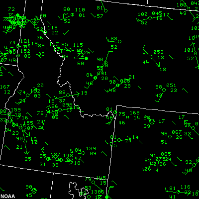
In the area of interest, relative humidity values were in the 20s during the initial outflow event with recoveries into the 30s. Skies were partly cloudy.
Examine the data products below (you can click them to see enlarged versions) to form an understanding of the weather context for this fire. Data source locations are indicated on the basemap.
Text Products
RAWS Data
Station GOES ID Elev Lat Long
===========================================================
MT WICKED CREEK 323F2314 7604 45:16:14 110:32:36
Dew Fuel Peak Bat Fuel
Day/Time Tmp Pt Wind Pcpn Rh Temp Wind Volt Moist
====================================================================================
MT WICKED CREEK 17/1401Z 48/ 34/3006/ 1.60 RH 59 FT 32/ 32G10 13.1 FM 0 SR 120
MT WICKED CREEK 17/1301Z 48/ 35/3401/ 1.60 RH 61 FT 32/ 34G03 12.8 FM 0 SR 84
MT WICKED CREEK 17/0201Z 68/ 46/1808/ 1.56 RH 46 FT 32/ 24G26 13.2 FM 0 SR 48
MT WICKED CREEK 17/0101Z 73/ 43/1807/ 1.53 RH 34 FT 32/ 14G18 14.1 FM 0 SR 455
MT WICKED CREEK 17/0001Z 74/ 41/1909/ 1.53 RH 31 FT 32/ 17G20 14.2 FM 0 SR 407
MT WICKED CREEK 16/2301Z 74/ 42/1711/ 1.53 RH 32 FT 32/ 20G24 14.2 FM 0 SR1114
MT WICKED CREEK 16/2201Z 75/ 42/2011/ 1.53 RH 31 FT 32/ 21G22 14.2 FM 0 SR 611
MT WICKED CREEK 16/2101Z 80/ 44/2609/ 1.53 RH 29 FT 32/ 25G23 14.1 FM 0 SR MM
MT WICKED CREEK 16/2001Z 79/ 43/2804/ 1.53 RH 28 FT 32/ 24G19 14.2 FM 0 SR MM
MT WICKED CREEK 16/1901Z 74/ 44/1509/ 1.53 RH 35 FT 32/ 14G17 14.3 FM 0 SR MM
MT WICKED CREEK 16/1801Z 75/ 43/1508/ 1.53 RH 33 FT 32/ 16G16 14.2 FM 0 SR MM
MT WICKED CREEK 16/1701Z 75/ 45/1609/ 1.53 RH 35 FT 32/ 14G16 13.9 FM 0 SR MM
MT WICKED CREEK 16/1601Z 71/ 40/1710/ 1.53 RH 33 FT 32/ 18G15 14.0 FM 0 SR1438
MT WICKED CREEK 16/1501Z 69/ 37/1613/ 1.53 RH 31 FT 32/ 16G17 14.5 FM 0 SR1029
MT WICKED CREEK 16/1401Z 68/ 34/1708/ 1.53 RH 29 FT 32/ 16G12 13.3 FM 0 SR 491
MT WICKED CREEK 16/1301Z 63/ 33/2604/ 1.53 RH 33 FT 32/ 15G06 12.8 FM 0 SR 96
MT WICKED CREEK 16/0201Z 77/ 41/1011/ 1.30 RH 28 FT 32/ 07G22 13.1 FM 0 SR 24
MT WICKED CREEK 16/0101Z 79/ 40/0914/ 1.30 RH 25 FT 32/ 08G20 14.3 FM 0 SR 168
MT WICKED CREEK 16/0001Z 80/ 42/0712/ 1.30 RH 26 FT 32/ 07G22 14.4 FM 0 SR 144
MT WICKED CREEK 15/2301Z 84/ 43/3310/ 1.30 RH 24 FT 32/ 32G17 14.0 FM 0 SR 563
MT WICKED CREEK 15/2201Z 83/ 45/3113/ 1.30 RH 27 FT 32/ 31G19 14.0 FM 0 SR1066
MT WICKED CREEK 15/2101Z 77/ 44/3212/ 1.30 RH 32 FT 32/ 32G19 14.1 FM 0 SR 311
MT WICKED CREEK 15/2001Z 78/ 45/3111/ 1.30 RH 32 FT 32/ 32G19 14.2 FM 0 SR 611
MT WICKED CREEK 15/1901Z 75/ 42/3113/ 1.30 RH 31 FT 32/ 31G19 14.5 FM 0 SR 503
MT WICKED CREEK 15/1801Z 75/ 43/3113/ 1.30 RH 33 FT 32/ 31G17 14.6 FM 0 SR MM
MT WICKED CREEK 15/1701Z 77/ 44/2903/ 1.30 RH 31 FT 32/ 31G05 13.9 FM 0 SR MM
MT WICKED CREEK 15/1601Z 75/ 44/3302/ 1.30 RH 34 FT 32/ 13G04 13.9 FM 0 SR1438
MT WICKED CREEK 15/1501Z 72/ 41/1304/ 1.30 RH 33 FT 32/ 12G06 14.6 FM 0 SR 491
MT WICKED CREEK 15/1401Z 70/ 43/1102/ 1.30 RH 38 FT 32/ 12G05 13.2 FM 0 SR 359
MT WICKED CREEK 15/1301Z 67/ 41/1704/ 1.30 RH 39 FT 32/ 17G06 12.8 FM 0 SR 7
NOAA/BLM
Fire Behavior
Question
What kind of fire behavior do you think resulted from the combination of fuels, topography, and weather conditions you have seen for this event?
- Smoldering, creeping surface fire
- Active surface fire with isolated torching and short-range spotting
- Extreme fire behavior with an independent crown run and erratic spotting
Feedback
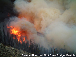
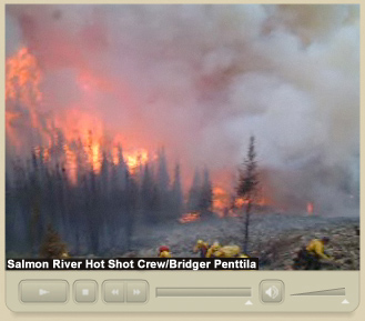
The correct answer is 3. This fire produced an intense short-duration crown run that was independent of the surface fire. Down-canyon outflow winds helped a fairly low-intensity surface fire transition to the forest canopy, where it blew up into a crown run that was estimated to spread 100-150 acres in 8-10 minutes. Once the fire was established in the canopy, it pushed strongly up-canyon. This push was enhanced by the surrounding terrain (chimney effect) and localized strong winds generated by the fire. Several spot fires resulted during this crown run.
At the same time, another outflow was generated by a more moist rain cell located up-canyon from the crown fire. The plume generated by the crown fire was undercut by this outflow and ended up providing additional spotting across the Mission Creek drainage. Steady rain quickly set in after the plume collapse and subsequently ended this short-duration fire event.
Review the following photos and video clips to see what happened.
Videos
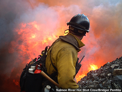
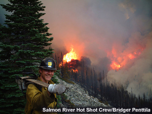
The following videos illustrate the types of fire behavior observed. The first video clip, recorded by a member of the Bridger fire crew on the afternoon of August 16th, 2003, shows some dramatic footage of the crown fire in the trees below the scree slope.
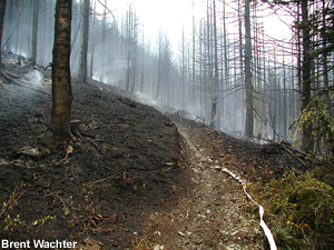
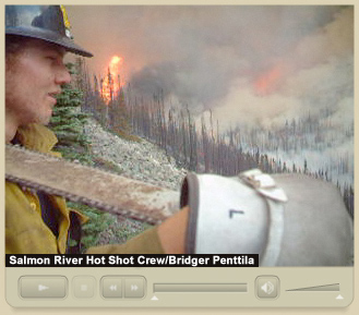
The second video clip, recorded 2 minutes after the preceding one, shows the results of the crown fire. The forested area below the crew has been completely transformed.
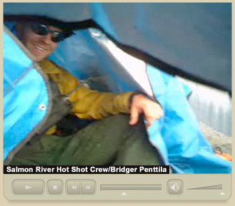
The last video clip, recorded 10 minutes after the previous sequences, shows the crew members taking shelter under tarps as winds have shifted and rains arrived. Rain became steady between 17:10-17:20, causing fire activity to rapidly decrease. Fifteen to twenty hundredths of an inch of rain fell later that day.
Causal Factors
Question
Why did this part of the Rough Draw fire develop into an intense crown fire? Select the main factors that allowed this to happen. (Choose all that apply from the list below.)
- Extremely dry surface fuels
- Abundand ladder fuels
- Dry dead & down jackpots
- Continuous and dry canopy
- Densely packed forest
- Trees had fairly high live fuel moisture levels
- Steep terrain with chimney formations
- Low soil moisture levels
- South-facing aspect
- Strong, gusty outflow winds
- Temperatures well above normal
- Very low humidity
Feedback
The correct answers are 2, 3, 4, 5, 7, and 10. Fuels, topography, and weather factors all came into play. The crown fire broke out within a forested area that was densely packed with a continuous and dry canopy. Topography was steeply sloped and upper reaches of the drainages above the fire acted as chimneys when up-canyon winds were co-aligned. Finally, the fire was intensified by strong, gusty outflow winds from showers ahead of the approaching front.
Other factors facilitated the transition of the surface fire into the canopy. These included fuel jackpots, low live fuel moistures in the tree canopies, and efficient laddering within the sub-alpine fir. (This conifer is notorious for efficient torching during drought years because its limbs reach fairly close to the ground.)
Although soil and duff layers were dry, many of the surface fuels were only partially cured. Afternoon RH levels were also not considered to be particularly low. These mitigating factors reduced surface fire intensity both prior to and during the crown fire event. As a result, the fire propagated as an independent crown fire.
You have now completed this case study.

