Fire Behavior Case Studies
Cascade Complex Wildfire
Return to main page of print version
Introduction
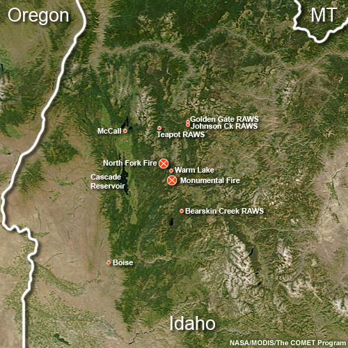
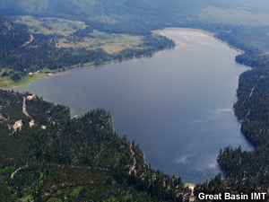
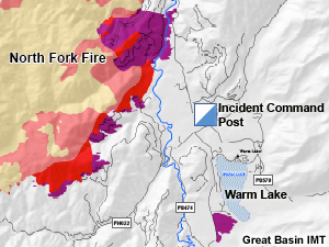
This case study examines a wildfire complex that burned in west-central Idaho during August, 2007. The fires occured in an area of varied terrain to the north and south of Warm Lake. At same time, much of Idaho seemed to be in flames. As of August 11th, 36 uncontained large fires were reported to be burning in the Northern Rockies and Eastern Great Basin regions.
Review the Fuels, Topography, and Weather sections (below) to learn about the environmental conditions for this fire.
Then, continue to the Fire Behavior section to make a prediction about the types of fire behavior you would expect for the given conditions. Once you have made this prediction, go to the Causal Factors section to answer a summary question about the causal factors for this fire.
Fuels
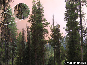
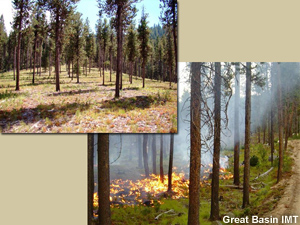
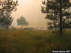
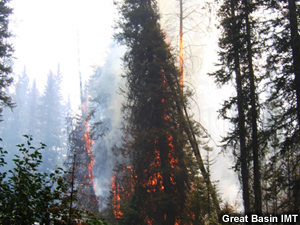
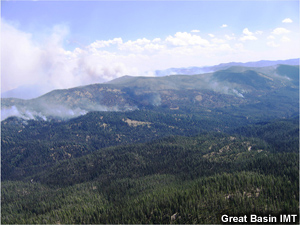
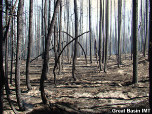
Forests in the fire region included a mix of lodgepole pine and sub-alpine fir, which was dense enough in many areas to form a continuous canopy. In addition, the lichen usnea (Old Man's Beard) was observed growing from brances throughout the forest. This lichen, where plentiful, can contribute significantly to spotting.
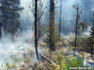
Large amounts of dead and down fuels and significant laddering materials were present in the forests. However, some areas had much less surface fuel loading, thanks to prior fuel reduction projects and ongoing burnout operations.
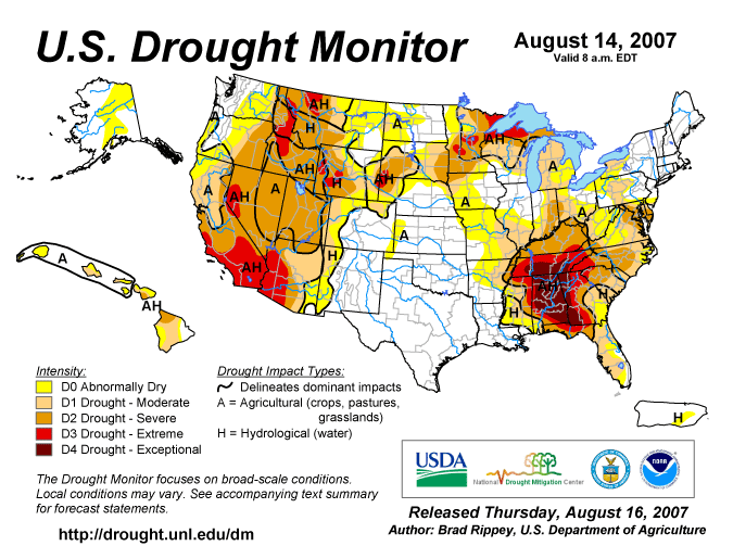
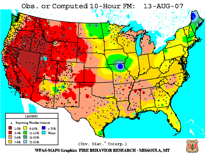
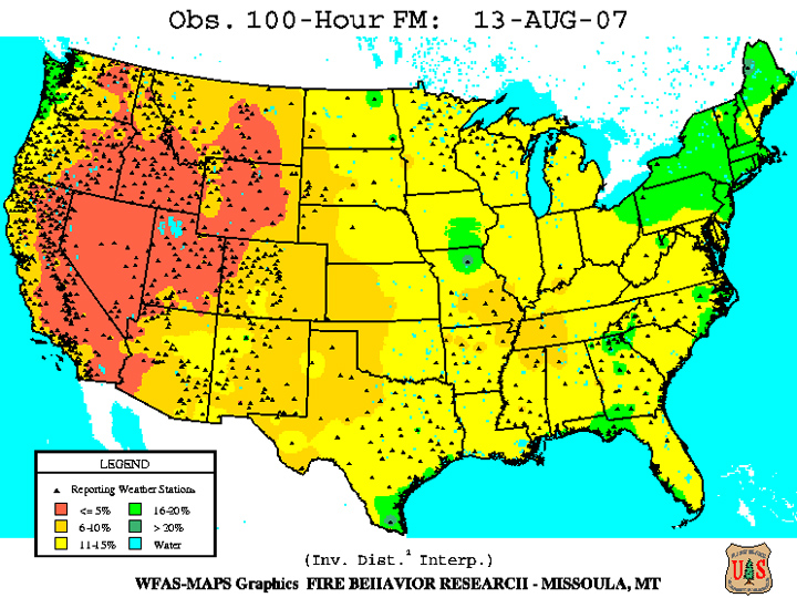
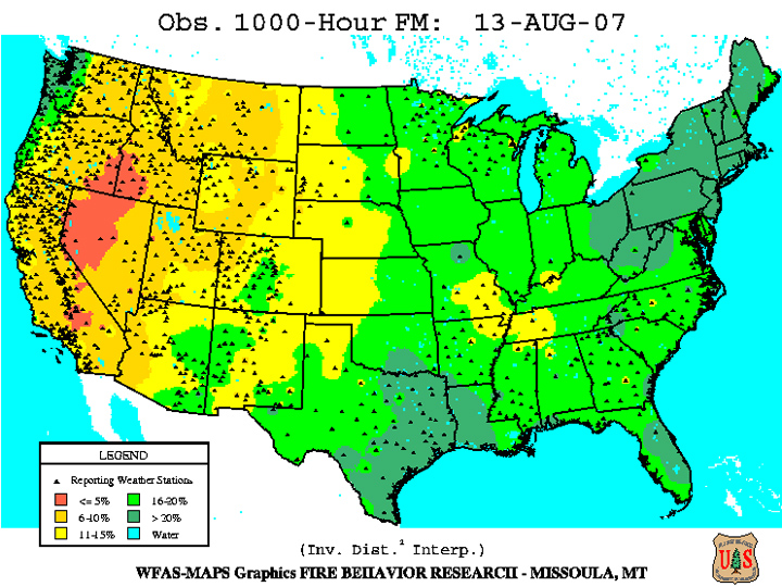
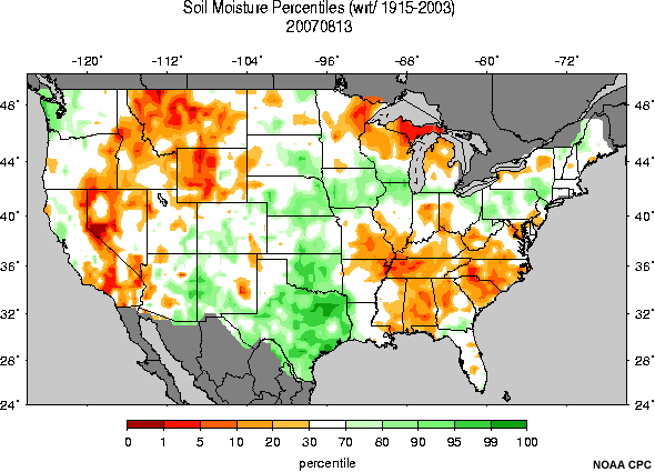
A preexisting drought was present in the region, and fuel moisture levels, especially in the heavier fuels, were very low. Energy Release Component (ERC) values were at historic high levels, as were probabilities of ignition. However, herbaceous vegetation at the surface was relatively green, a fact which made the burn-out activities feasible, despite the dry conditions.
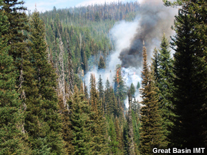
Examine the photos and data products below (you can click them to see enlarged versions) to form an understanding of the fuel situation for this fire. For more information about the data products presented, refer to the Assessing Fire Danger module in the Advanced Fire Weather Forecasters Course.
Topography
The Jungle wildfire occurred in southern Montana on the northern edge of the Absaroka Mountain Range. The fire consumed forested sections of the West Boulder River canyon, which has a southwest-northeast orientation. Burned areas ranged in altitude from 6200 to 9600 ft. Mountain peaks on either side of this canyon reach above 10,000 ft elevation.
The terrain is varied; many of the upper reaches are steep and inaccessible. Soil moisture levels throughout the area were dry.
Examine the photos below (you can click them to see enlarged versions) to form an understanding of the terrain configuration for this fire.
Weather
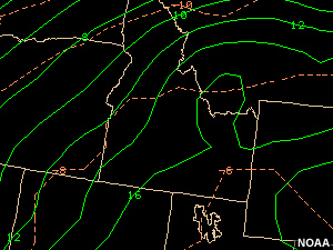
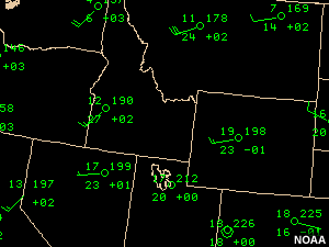
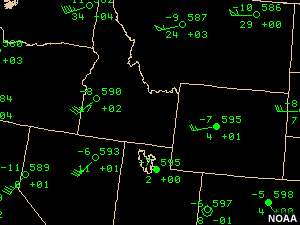
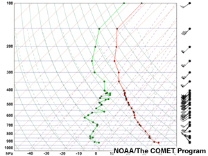
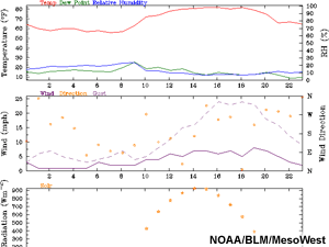
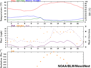
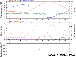
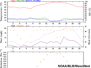
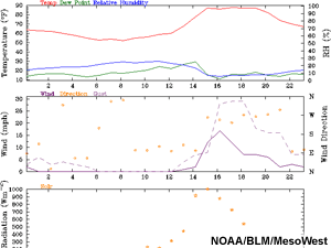
Weather conditions for this fire event were characterized by very low humidities, above-normal temperatures, high instability, and strong surface winds.
A Red Flag Warning was in effect for the region as a strong mid-level jet max in the base of an upper level trough pushed toward the area. Strong surface winds were forecast along with warm temperatures and minimum RH values of 5-10%.
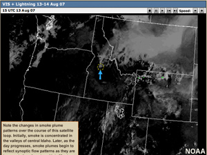
Examine the data products below (you can click them to see enlarged and looping versions) to form an understanding of the weather context for this fire. Data source locations are indicated on the basemap.
Fire Behavior
Question
What kind of fire behavior do you think resulted on August 13 from the combination of fuels, topography, and weather conditions you have seen for this event?
- Isolated individual torching, mostly within the thermal belt
- Group torching, mostly with and near the thermal belt
- Extreme fire behavior with independent crown runs, rapid spread, and long-range spotting
- All of the above
Feedback
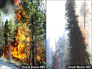
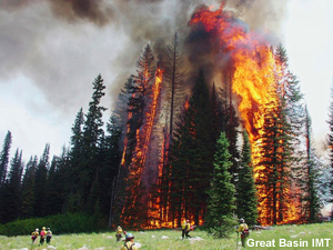
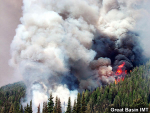
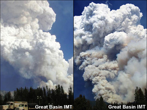
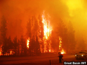
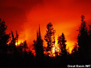
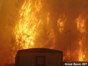
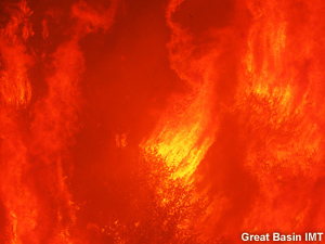
As it happened, a full range of fire behaviors occurred with the Cascade Complex fires on 13 August. Initially, the inversion suppressed the fire; while it was still in place, fire activity was limited to isolated individual tree torching, mostly within the thermal belt below the inversion. As the inversion began to break, group tree torching was observed. Finally, after the inversion broke allowing stronger winds and dry air to mix to the surface, the fire became extreme. The spread rate became very rapid and long-duration crown runs occurred. Due to the highly unstable conditions, the fire became extremely dangerous. Fire whirls and 300-ft flame lengths were observed, as were confirmed spotting distances of 5-7 miles. Unconfirmed reports estimate spotting distances as great as 15 miles.
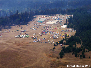
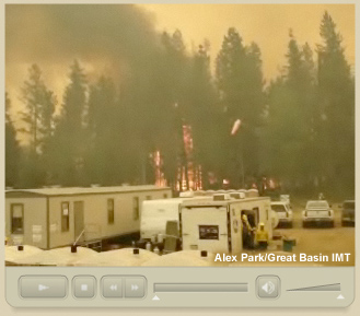
The North Fork and Monumental fires merged on this day, and swept over the area surrounding Warm Lake. Even the Incident Command Post was not immune, as you can see from the dramatic video footage of the burnover that occurred.
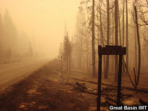
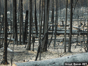
Review the following photos and video clip to see what happened.
Video Clip
This video clip, recorded by Alex Parks of Paul Broyles' Type I Great Basin Incident Management Team, shows the scene as the North Fork fire reached the Incident Command Post. No injuries were reported, but one yurt and 5 firefighter tents were destroyed. As you watch the video, look for fire whirls that form in the intense flare-up at the forest edge. You should also note the strong gusty winds and intermittent 'rains' of burning embers that fall on the camp.
Causal Factors
Question
Why did this fire transition from isolated torching to extreme fire behavior? What causal factors allowed extreme fire behavior to develop? (Choose all that apply from the list below.)
- Record high Energy Release Component values
- Dense forests and continuous canopies
- Plentiful dead and down fuels in some areas
- Plentiful ladder fuels in some areas
- Extremely dry herbaceous plants at the surface
- Pre-existing drought and low fuel moisture levels
- Extremely steep terrain with chimney formations
- Low soil moisture levels
- Low humidities and above-normal temperatures
- Strong thermal belt at the surface
- Significant instability
- Very dry atmosphere at mid-levels
- Arrival of a mid-level jet max
Feedback
The correct answers are 1, 2, 3, 4, 6, 8, 9, 10, 11, 12, and 13. There were three main causal factors for the transition to extreme fire behavior, very dry fuels, compact fuel arrangement, and critical fire weather conditions. The pre-existing extreme drought conditions had turned the forest into a tinderbox. Energy Release Component (ERC) values were at record levels and fuel moisture levels were very low. In addition, although fuel reduction efforts were ongoing, many parts of the forest were densely packed with continuous canopies.
Additionally, and unlike the Rombo Mountain fire event in Montana, weather conditions were favorable for extreme fire development. Temperatures were unseasonably high and RH values very low. The atmosphere was unstable, with very dry air found at mid levels. Once the mid-level jet max arrived and the inversion broke, gusty dry winds mixed down to the surface and vigorous convection supported the development of large fire columns.
You have now completed the Fire Behavior learning module. Check your knowledge by taking the Module Quiz.

